Sunday, March 31, 2013
update on the thunderstorms
From the National Weather Service:
AFTERNOON SHOWERS AND THUNDERSTORMS WILL CONTINUE IN THE VALLEY AND
SURROUNDING FOOTHILLS THROUGH THE EVENING. THE STORMS ARE
WIDELY SCATTERED THROUGH THE REGION...WITH STORM CELLS AT 245 PM
NEAR THE TOWNS OF TRACY...LATHROP...NEWVILLE...HIDDEN VALLEY...AND
GUINDA.
REMEMBER ALL THUNDERSTORMS ARE DANGEROUS WITH POSSIBLE HAIL...HEAVY
RAIN...LIGHTNING...AND GUSTING WINDS. MOTORISTS SHOULD BE
PREPARED FOR HAZARDOUS DRIVING CONDITIONS. IF CAUGHT
OUTDOORS...SEEK SHELTER IMMEDIATELY.
Remember, you can keep track of the thunderstorms on radar with the Weather Channel link to the Northern California radar at weather.com. The link is on the right hand side of the home page. Just scroll down until you locate it.
Saturday, March 30, 2013
unsettled weather for Easter weekend
Yesterday's weather in Chico was absolutely gorgeous, with sunny skies and highs in the upper 70s and lower 80s. Kiss that kind of weather goodbye for now, because a weak low pressure system will be moving into our area later today and will hang out through the weekend like an obnoxious family member with impeccably bad timing. Easter egg hunts and sunrise services could be affected by these showers, so plan accordingly. Temperatures will be coolish, but right around where we should be for the end of March. Dry weather returns just in time for the work week, with sunny skies Monday through Wednesday. Then another low pressure system invades towards the end of next week, bringing another risk of showers for next weekend. We do need the rain, but couldn't it have held off until after the weekend? Here's Chico's seven day outlook courtesy of the National Weather Service:
Today Scattered showers after 11am. Mostly cloudy, with a high near 73. South wind around 6 mph becoming calm in the afternoon. Chance of precipitation is 30%. New precipitation amounts of less than a tenth of an inch possible.
Tonight Showers likely, mainly before 11pm. Mostly cloudy, with a low around 50. Light and variable wind. Chance of precipitation is 60%. New precipitation amounts between a tenth and quarter of an inch possible.
Sunday Showers likely, then showers and possibly a thunderstorm after 11am. High near 67. South southeast wind 3 to 7 mph. Chance of precipitation is 80%. New rainfall amounts between a tenth and quarter of an inch, except higher amounts possible in thunderstorms.
Sunday Night Showers likely and possibly a thunderstorm before 11pm, then a chance of showers. Mostly cloudy, with a low around 49. East wind 3 to 6 mph. Chance of precipitation is 60%. New rainfall amounts of less than a tenth of an inch, except higher amounts possible in thunderstorms.
Monday A 20 percent chance of showers. Partly sunny, with a high near 70. Calm wind.
Monday Night Partly cloudy, with a low around 48.
Tuesday Sunny, with a high near 74.
Tuesday Night Mostly clear, with a low around 49.
Wednesday Mostly sunny, with a high near 75.
Wednesday Night A slight chance of showers. Mostly cloudy, with a low around 50.
Thursday A chance of showers. Mostly cloudy, with a high near 68.
Thursday Night A chance of showers. Mostly cloudy, with a low around 49.
Friday A chance of showers. Mostly cloudy, with a high near 70.
Thursday, March 28, 2013
off-and-on wet this weekend
It appears we will see some wet weather this weekend in the Northstate, but it's not going to be a washout. A fairly weak area of low pressure will move through over the weekend, bringing scattered showers and isolated thunderstorms to the valley, and scattered snow showers to the Sierra Nevada above 6000 feet (2-6 inches of snow are likely). Today we'll see a chance of scattered showers with highs in the upper 60s. Tomorrow is expected to be sunny and warmer, with mid 70s for highs. Then the showery weather returns for both Saturday and Sunday. Again, it won't rain all day both days, but be aware of potentially wet conditions for any Easter egg hunts or Sunrise Services. Here is Chico's detailed forecast from the National Weather Service:
Today Scattered showers, mainly after 11am. Mostly cloudy, with a high near 68. Southeast wind around 9 mph. Chance of precipitation is 30%. New precipitation amounts of less than a tenth of an inch possible.
Tonight Isolated showers before 11pm. Mostly cloudy, with a low around 48. South southeast wind 5 to 7 mph becoming north northeast after midnight. Chance of precipitation is 20%.
Friday Mostly sunny, with a high near 74. North wind 5 to 7 mph.
Friday Night Mostly cloudy, with a low around 50. Light and variable wind becoming northeast 5 to 7 mph after midnight.
Saturday A slight chance of showers, then a chance of showers and thunderstorms after 11am. Mostly cloudy, with a high near 70. North northeast wind around 6 mph becoming light and variable in the morning. Chance of precipitation is 40%.
Saturday Night A chance of showers and thunderstorms. Mostly cloudy, with a low around 50. Chance of precipitation is 50%.
Sunday A chance of showers, with thunderstorms also possible after 11am. Mostly cloudy, with a high near 66. Chance of precipitation is 50%.
Sunday Night A chance of showers and thunderstorms. Mostly cloudy, with a low around 48.
Monday A slight chance of showers. Partly sunny, with a high near 69.
Monday Night Partly cloudy, with a low around 46.
Tuesday Mostly sunny, with a high near 73.
Tuesday Night Partly cloudy, with a low around 47.
Wednesday Mostly sunny, with a high near 73.
Wednesday, March 27, 2013
potential for a wet Easter weekend
From the National Weather Service office in Sacramento:
SPRING STORM WILL BRING COOLER AND WETTER WEATHER FOR THE
HOLIDAY WEEKEND...
IMPACTS:
* OUTDOOR ACTIVITIES COULD BE IMPACTED BY WET CONDITIONS AND POSSIBLE
AFTERNOON THUNDERSTORMS.
* POSSIBLE TRAVEL DELAYS AND CHAINS REQUIREMENTS OVER SIERRA
NEVADA PASSES.
A SLOW MOVING PACIFIC STORM WILL GRADUALLY APPROACH NORTHERN
INTERIOR CALIFORNIA TOWARD THE END OF THE WEEK. A WEAK DISTURBANCE
AHEAD OF THIS COULD BRING GENERALLY LIGHT SHOWERS THROUGH FRIDAY.
THE MAIN LOW PRESSURE CENTER WILL MOVE INLAND OVER THE WEEKEND.
THIS RELATIVELY MILD SYSTEM WILL BRING SOME HIGH ELEVATION SNOW
AND VALLEY RAIN BEFORE IT EXITS EARLY NEXT WEEK.
SNOW AND RAIN AMOUNTS ARE UNCERTAIN AT THIS TIME BUT COULD CAUSE
TRAVEL DIFFICULTIES. CURRENTLY THERE IS THE POTENTIAL FOR UP TO A
THIRD OF AN INCH OF RAIN IN THE CENTRAL VALLEY AND SEVERAL INCHES
OF SNOW ABOVE 6000 FEET.
AFTERNOON AND EVENING THUNDERSTORMS ARE ALSO A POSSIBILITY OVER
THE WEEKEND.
Tuesday, March 26, 2013
showers for this weekend?
A quick-moving, weak disturbance moved through yesterday, bringing mainly high-based (read: mountain) rain showers. The valley remained precipitation-free yesterday. It was mostly cloudy, with a high temperature in Chico of 71 degrees. Today should be mainly sunny, with a high right around 70 degrees. As we get later into the week, look for shower chances to increase and become more widespread. There is no heavy rain or storminess expected with this next trough of low pressure. Highs will stay in the upper 60s to mid 70s, while lows will be in the 40s. Here are the details for Chico from the National Weather Service:
Today Mostly sunny, with a high near 69. Southeast wind 5 to 7 mph becoming calm.
Tonight Mostly cloudy, with a low around 46. South southeast wind around 7 mph becoming east in the evening.
Wednesday A 20 percent chance of showers. Partly sunny, with a high near 68. South wind 3 to 7 mph. New precipitation amounts of less than a tenth of an inch possible.
Wednesday Night A 20 percent chance of showers before 11pm. Mostly cloudy, with a low around 47. East southeast wind around 7 mph.
Thursday A 30 percent chance of showers. Mostly cloudy, with a high near 68. South southeast wind around 7 mph.
Thursday Night A 20 percent chance of showers. Mostly cloudy, with a low around 47.
Friday A 20 percent chance of showers. Partly sunny, with a high near 74.
Friday Night A slight chance of showers. Mostly cloudy, with a low around 47.
Saturday A chance of showers. Mostly cloudy, with a high near 73.
Saturday Night A chance of showers. Mostly cloudy, with a low around 46.
Sunday A chance of showers. Partly sunny, with a high near 70.
Sunday Night A chance of showers. Mostly cloudy, with a low around 47.
Monday A chance of showers. Mostly cloudy, with a high near 69.
Sunday, March 24, 2013
a change in the weather
We could not ask for better spring weather than what we've seen the past few days. It was a touch breezy Friday and yesterday, but the sun was out and the temperatures were nearly perfect- mid to upper 60s. The wonderful spring weather will continue today, with sunshine and highs on either side of 70 degrees. Today is the annual Chico Kite Day at Community Park. It's a free, family-friendly event, with food, music, and contests for best kite. It happens from noon until 4 pm. Yesterday may have been a better day to fly a kite, as the winds will be a lot calmer today. Still, it's a good reason to get out and soak up some sun! There is a change in the weather for this updoming week, as a trough of low pressure digs in and chips away at the high pressure that's been dominating our weather the past several days. This appears to be a weak low pressure system, as there is no heavy rain or wind event coming. There will be a prolonged period of off-and-on showers from Wednesday into next weekend, so make sure that umbrella is handy. High temperatures this week will be in the low 70s today through Tuesday, while Wednesday through Friday highs will dip into the upper 60s. Here is Chico's seven day outlook in more detail from the National Weather Service:
Today Mostly sunny, with a high near 73. Light and variable wind.
Tonight Partly cloudy, with a low around 43. South wind around 5 mph becoming light and variable after midnight.
Monday Mostly sunny, with a high near 71. Calm wind becoming south southeast 5 to 7 mph in the afternoon.
Monday Night Partly cloudy, with a low around 46. East southeast wind around 8 mph.
Tuesday Partly sunny, with a high near 71. South wind 5 to 8 mph.
Tuesday Night A 20 percent chance of showers. Mostly cloudy, with a low around 48.
Wednesday A 40 percent chance of showers. Mostly cloudy, with a high near 68.
Wednesday Night A chance of showers. Mostly cloudy, with a low around 45.
Thursday A chance of showers. Mostly cloudy, with a high near 67.
Thursday Night A chance of showers. Mostly cloudy, with a low around 45.
Friday A chance of showers. Mostly cloudy, with a high near 69.
Friday Night A chance of showers. Mostly cloudy, with a low around 45.
Saturday A chance of showers. Mostly cloudy, with a high near 72.
Friday, March 22, 2013


Could it be any more beautiful?
Really? Could it? Spring is definitely here in Northern California, as the grass is a deep emerald green, the trees are leafing out, and sunny weather hods reign. This weekend is going to be a picture perfect one, with sunshine and highs in the lower 70s. There is a chance we could see some shower activity by the middle of next week; otherwise, expect dry weather and mild temperatures for the next several days. Also, I'm issuing a Bad Hair Day Alert for today, as northerly winds could gust up to 40 mph (even stronger than yesterday). Layer on the hairspray! Here are the specifics for Chico from the National Weather Service:
Today Sunny, with a high near 67. North northwest wind 9 to 15 mph, with gusts as high as 20 mph.
Tonight Clear, with a low around 38. North wind 8 to 14 mph, with gusts as high as 18 mph.
Saturday Sunny, with a high near 72. Northwest wind 7 to 9 mph.
Saturday Night Mostly clear, with a low around 41. Northwest wind around 6 mph becoming north northeast in the evening.
Sunday Sunny, with a high near 74. Northwest wind 6 to 9 mph.
Sunday Night Mostly clear, with a low around 42.
Monday Mostly sunny, with a high near 72.
Monday Night Partly cloudy, with a low around 43.
Tuesday Partly sunny, with a high near 70.
Tuesday Night A slight chance of showers. Mostly cloudy, with a low around 45.
Wednesday A chance of showers. Mostly cloudy, with a high near 68.
Wednesday Night A chance of showers. Mostly cloudy, with a low around 46.
Thursday A chance of showers. Partly sunny, with a high near 69.
Wednesday, March 20, 2013
first day of spring is a wet one
Happy first day of spring! Did you know the first day of spring is a national holiday in Japan? I think the Japanese are much more in tune with nature than we are here in the West. Anyway, the spring equinox is continuing to be a wet one here in California. Chico has received .33" as of 6 am this morning. Showers will continue off-and-on today, along with breezy winds between 15-20 mph. Chico could see another quarter inch of rain, while the highest elevations of the Sierra Nevada could get another 3-6 inches of snow. This will occur mainly at pass level, so if driving on I-80 or Highway 50, use caution. The sunny and mild weather will return tomorrow and last through the middle of next week. High temperatures after today will be seasonable- mainly upper 60s to lower 70s. It could be a bit windy Thursday and Friday behind this cold front currently moving through the area. A Bad Hair Day Alert may be needed. Here's Chico's seven day outlook courtesy of the National Weather Service:
Today Showers. High near 64. Southeast wind 13 to 16 mph, with gusts as high as 21 mph. Chance of precipitation is 90%. New precipitation amounts between a tenth and quarter of an inch possible.
Tonight A 30 percent chance of showers, mainly before midnight. Mostly cloudy, with a low around 43. South southeast wind 10 to 15 mph becoming light and variable after midnight. Winds could gust as high as 20 mph. New precipitation amounts of less than a tenth of an inch possible.
Thursday Mostly sunny, with a high near 69. Northwest wind 7 to 10 mph.
Thursday Night Mostly clear, with a low around 39. Northwest wind around 10 mph.
Friday Sunny, with a high near 68. North northwest wind 10 to 14 mph, with gusts as high as 18 mph.
Friday Night Mostly clear, with a low around 36.
Saturday Mostly sunny, with a high near 69.
Saturday Night Mostly clear, with a low around 39.
Sunday Sunny, with a high near 70.
Sunday Night Mostly clear, with a low around 41.
Monday Sunny, with a high near 71.
Monday Night Partly cloudy, with a low around 43.
Tuesday Mostly sunny, with a high near 71.
Monday, March 18, 2013
update on the latest storm
From the National Weather Service office in Sacramento:
ABOVE NORMAL TEMPERATURES OF THE PAST WEEK WILL BE REPLACED BY
COOLER WEATHER ALONG WITH RAIN AND HIGH-ELEVATION SNOW BY TUESDAY
AND WEDNESDAY. CHANCES OF PRECIPITATION WILL INCREASE BY TUESDAY
NIGHT. THE RAIN AND SNOW WILL TAPER TO SHOWERS BY WEDNESDAY
AFTERNOON.
IMPACTS:
*POSSIBLE TRAVEL DELAYS AND CHAINS REQUIREMENTS IN THE SIERRA
NEVADA.
*SLICK ROADWAYS COULD LEAD TO AN INCREASE IN TRAFFIC ACCIDENTS.
SNOW LEVELS WILL BE HIGH WITH THIS SYSTEM SO ONLY THE HIGHER
ELEVATION MOUNTAIN PASSES ARE EXPECTED TO BE AFFECTED BY
ACCUMULATING SNOW. INTERSTATE 80 AND HIGHWAYS 50 AND 88 WILL
LIKELY SEE SNOW ACCUMULATING ON THE ROADWAYS BELOW THE PASS
LEVELS. MOTORISTS TRAVELING INTO THE NORTHERN SIERRA NEVADA
SHOULD BE PREPARED FOR POSSIBLE TRAVEL DELAYS AND CARRY CHAINS.
SNOW ACCUMULATIONS OF 4 TO 8 INCHES WILL BE POSSIBLE BELOW PASS
LEVELS DOWN TO AROUND 6500 FEET WITH MINOR ACCUMULATIONS POSSIBLE
BELOW THAT LEVEL. LOCALLY HIGHER AMOUNTS ARE POSSIBLE ALONG THE
CREST.
RAINFALL AMOUNTS WITHIN THE VALLEY WILL GENERALLY RANGE FROM A
QUARTER TO A HALF AN INCH OF RAINFALL. RAINFALL AMOUNTS OVER THE
FOOTHILLS WILL RANGE FROM ONE HALF TO ONE INCH OF RAIN WITH
LOCALLY HIGHER AMOUNTS. ROADS WILL BECOME SLICK SO MOTORISTS
SHOULD INCREASE FOLLOWING DISTANCES.
Sunday, March 17, 2013
rain for mid-week
Happy St. Patrick's Day! Yesterday was perfect spring weather in Chico, with light winds, mainly sunny skies, and a high temperature of 76 degrees. Clouds increased late yesterday afternoon as a weak cold front moved through. Winds increased out of the northwest last evening behind the front, gusting over 20 mph. It has been chilly this morning, with a current temperature at the Chico State University Farm at 38 degrees. It should be another lovely day today, with sunny skies and highs in the lower 70s. Tomorrow should be a carbon copy of today, and then the clouds increase on Tuesday as a rapidly moving storm moves through the area Tuesday night and Wednesday. Right now it doesn't look like we're going to see a lot of precipitation with this storm- I'd say a half an inch of rain at the most for Chico. The snow level will be above 6000 feet, with perhaps a half a foot of snow possible above that elevation. Highs in the valley Tuesday and Wednesday will dip into the 60s. Then spring returns by Thursday, with sunshine and highs back into the 70s through next weekend. Have a great week! Here's Chico's seven day forecast courtesy of the National Weather Service:
Today Sunny, with a high near 71. Northwest wind 9 to 13 mph.
Tonight Partly cloudy, with a low around 41. Northwest wind 5 to 7 mph becoming calm in the evening.
Monday Mostly sunny, with a high near 72. North wind around 5 mph becoming light and variable.
Monday Night Mostly cloudy, with a low around 46. Light and variable wind.
Tuesday A 30 percent chance of rain. Mostly cloudy, with a high near 65. Calm wind becoming east 5 to 7 mph in the afternoon.
Tuesday Night Rain. Low around 47. Chance of precipitation is 80%.
Wednesday Showers likely. Cloudy, with a high near 66. Chance of precipitation is 70%.
Wednesday Night A slight chance of showers. Mostly cloudy, with a low around 44.
Thursday Sunny, with a high near 72.
Thursday Night Mostly clear, with a low around 43.
Friday Sunny, with a high near 76.
Friday Night Mostly clear, with a low around 46.
Saturday Sunny, with a high near 78.
Friday, March 15, 2013
Nice weekend weather, and some events happening in Chico
It will be a wonderful weather weekend in Chico, with highs in the mid to upper 70s and partly sunny skies. There is still some uncertainty about the next storm that is forecast to arrive around Tuesday of next week. Continue to stay tuned for updates. A couple of events happening in Chico this weekend include the annual Spring Home and Garden Show at the Silver Dollar Fairgrounds, and the annual Chico Bach Festival, which concludes tomorrow with this special concert (details courtesy of Chico State's Department of Theater and Music's Facebook page):
Chico Bach Festival: The Glorious Baroque
Saturday, March 16 at 7:30 p.m.
Harlen Adams Theatre
The North Valley Chamber Chorale and CSU, Chico music students perform music of Bach and his Baroque contemporaries in this eclectic concert. Works by Bach, Handel, Buxtehude, Pachelbel, Pergolesi and others will be featured.
Advance tickets, at $15 general, $13 senior citizens, and $6 students/children, are available at the University Box Office, corner of Second Street and Normal Avenue. Tickets are also available online at http://bit.ly/QyNdSj or by phone, 530.898.6333; additional $4 handling fee for phone and online ticket purchases. Add $2 for tickets purchased at the door. For special needs seating call 530.898.6333.
Have fun this weekend!
Thursday, March 14, 2013
first 80 degree day of the year
The high temperature in Chico yesterday hit 80 degrees- the first time this calendar year that has happened. While not a record high, it came close to the 83 degree record high set in 2004. I remember that year- it hit 91 degrees on St. Patrick's Day! Don't expect temps to be that warm this St. Patrick's Day. In fact, temps will be cooling down as this massive high pressure ridge begins to weaken by early next week. In fact, rain is expected to move back in by the middle of next week (fingers crossed!). Highs will slowly decrease from the upper 70s today to the mid 60s by next Wednesday. This weekend still looks nice, with sunny skies and highs in the mid 70s. Get out and enjoy! Here's Chico's seven day forecast courtesy of the National Weather Service:
Today Mostly sunny, with a high near 79. Northeast wind around 5 mph becoming calm.
Tonight Partly cloudy, with a low around 47. Calm wind becoming north northeast around 5 mph after midnight.
Friday Mostly sunny, with a high near 77. Northwest wind 6 to 8 mph.
Friday Night Partly cloudy, with a low around 46. North wind around 6 mph.
Saturday Mostly sunny, with a high near 76. Northwest wind around 8 mph.
Saturday Night Partly cloudy, with a low around 44.
Sunday Sunny, with a high near 74.
Sunday Night Partly cloudy, with a low around 44.
Monday Mostly sunny, with a high near 75.
Monday Night Mostly cloudy, with a low around 46.
Tuesday A slight chance of rain. Mostly cloudy, with a high near 71.
Tuesday Night A chance of rain. Mostly cloudy, with a low around 45.
Wednesday Showers likely. Mostly cloudy, with a high near 64.
Wednesday, March 13, 2013
temps well above average
It was a pleasant 73 degrees in Chico yesterday under partly to mostly cloudy skies. High temperatures will continue to be warmer than average by as much as 10-15 degrees. We should be seeing temperatures this time of year around 66 degrees; instead, we will see highs in the mid to upper 70s. Some warmer spots in the valley could top 80 degrees today and tomorrow! Highs in the mountains will climb into the 50s and lower 60s, aiding the snowmelt. It's rather early for the snowmelt; it doesn't usually occur until April and May. Overnight lows will only be in the mid 40s (normal lows are in the upper 30s for this time of year). No rain or snow is in the forecast the next seven days. The trees continue to leaf out, and the grass on the surrounding foothills is an emerald green. It's very pretty right now in the Northstate. If only we could get more precipitation. Here's Chico's seven day forecast from the National Weather Service:
Today Mostly sunny, with a high near 77. North northwest wind around 5 mph becoming calm in the morning.
Tonight Partly cloudy, with a low around 47. Light and variable wind.
Thursday Mostly sunny, with a high near 78. Northeast wind around 5 mph becoming calm in the morning.
Thursday Night Mostly cloudy, with a low around 48. Light and variable wind.
Friday Mostly sunny, with a high near 78. Northwest wind 6 to 8 mph.
Friday Night Mostly cloudy, with a low around 46.
Saturday Mostly sunny, with a high near 77.
Saturday Night Partly cloudy, with a low around 45.
Sunday Mostly sunny, with a high near 76.
Sunday Night Partly cloudy, with a low around 44.
Monday Mostly sunny, with a high near 76.
Monday Night Mostly cloudy, with a low around 45.
Tuesday Partly sunny, with a high near 71.
Monday, March 11, 2013
warm and dry
I have to leave for work, but here's Chico's warm and dry seven day forecast from the National Weather Service. Have a great day!
Today Sunny, with a high near 75. Light east southeast wind.
Tonight Mostly clear, with a low around 45. Calm wind.
Tuesday Sunny, with a high near 76. Light and variable wind.
Tuesday Night Partly cloudy, with a low around 47. Light and variable wind.
Wednesday Mostly sunny, with a high near 77. Calm wind.
Wednesday Night Partly cloudy, with a low around 48.
Thursday Partly sunny, with a high near 76.
Thursday Night Partly cloudy, with a low around 47.
Friday Mostly sunny, with a high near 76.
Friday Night Partly cloudy, with a low around 45.
Saturday Mostly sunny, with a high near 73.
Saturday Night Partly cloudy, with a low around 43.
Sunday Mostly sunny, with a high near 73.
Saturday, March 9, 2013
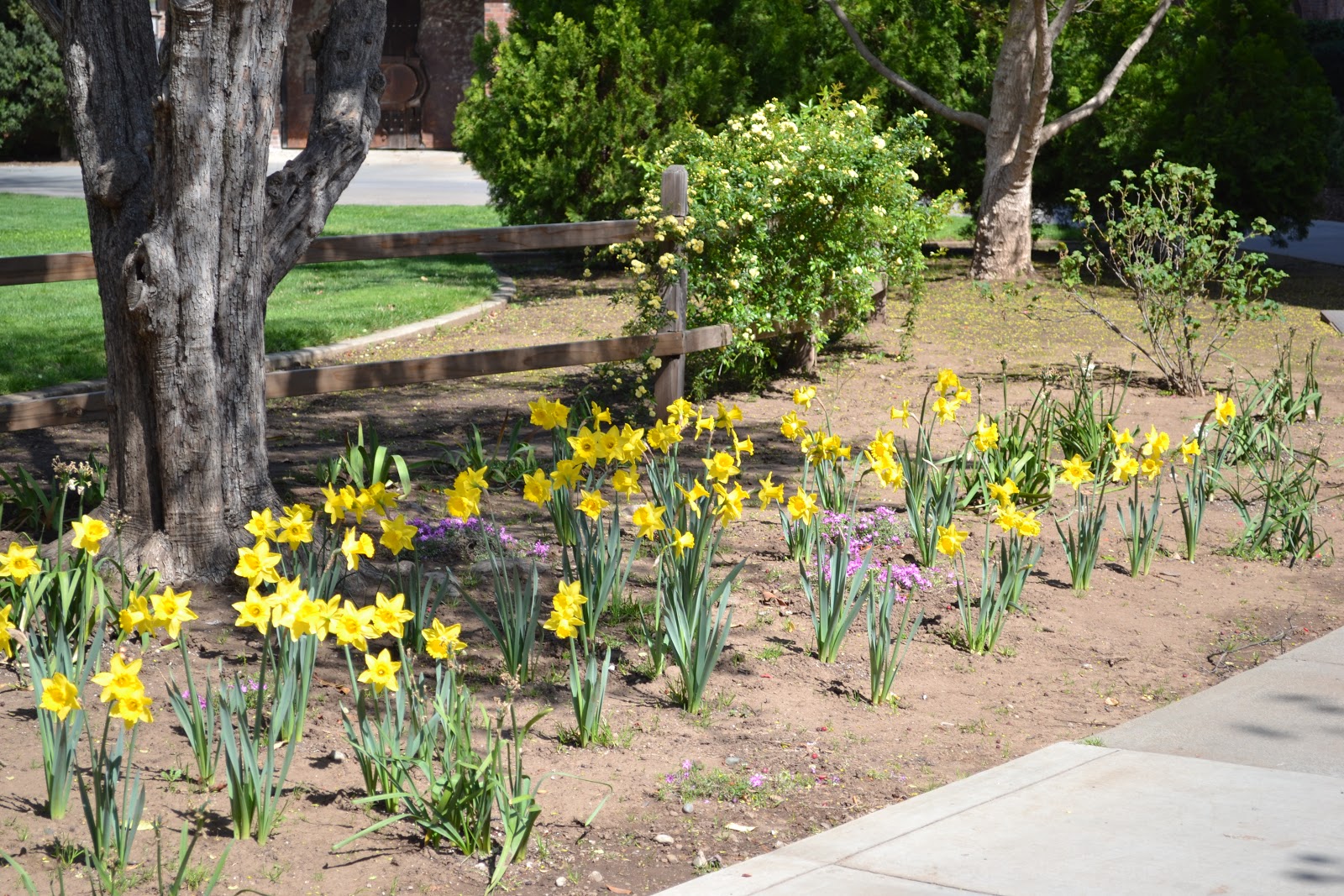
spring is bustin' out all over
Due to our Mediterranean climate, spring arrives in Northern California earlier than in most other parts of the country. It has definitely arrived now, as all of the flowering trees are in full bloom at this time- plum, cherry, pear, apple, almond- all in dazzling colors of white, pink, lavender and red. Even the non-flowering deciduous trees are beginning to leaf out, such as the ashes, maples, and walnuts. The next seven days will be nothing short of perfect weather-wise, with sunny days and highs in the low to mid 70s through the end of next week. Take a walk in Lower Bidwell Park or on the Chico State campus (which has been designated an arboretum) and enjoy all of the spring blooms. Or, travel to Upper Bidwell Park where the terrain is more rugged and natural and go for a hike. Play tennis on an outdoor court or bike one of the many bike trails in the city. Take advantage of this gorgeous weather, for the stifling heat of summer is not too far away! Here is Chico's spectacular forecast for the next seven days from the National Weather Service:
Today Sunny, with a high near 68. Northwest wind 6 to 13 mph.
Tonight Clear, with a low around 38. North wind around 6 mph.
Sunday Sunny, with a high near 72. West northwest wind around 7 mph.
Sunday Night Mostly clear, with a low around 41. Light and variable wind becoming east northeast around 5 mph in the evening.
Monday Sunny, with a high near 72. Northeast wind around 5 mph becoming calm in the morning.
Monday Night Mostly clear, with a low around 45.
Tuesday Mostly sunny, with a high near 75.
Tuesday Night Partly cloudy, with a low around 46.
Wednesday Mostly sunny, with a high near 75.
Wednesday Night Partly cloudy, with a low around 46.
Thursday Partly sunny, with a high near 75.
Thursday Night Partly cloudy, with a low around 45.
Friday Mostly sunny, with a high near 72.
Thursday, March 7, 2013
Hydrologic Outlook for California
From the National Weather Service:
THE SPRING FLOOD POTENTIAL OUTLOOK IS BELOW AVERAGE FOR ALL BASINS IN
CALIFORNIA. DRY ANTECEDENT SOIL MOISTURE CONDITIONS AND LOW
SNOWPACKS ARE MINIMIZING THE POTENTIAL FOR SPRING SNOWMELT FLOODING.
MUCH OF THE REGION HAS EXPERIENCED VERY DRY CONDITIONS AFTER A VERY
PRODUCTIVE NOVEMBER AND DECEMBER. MANY LOCATIONS HAVE RECORDED
PRECIPITATION AMONG THE TOP TEN LOWEST ON RECORD FOR THE COMBINED
MONTHS OF JANUARY AND FEBRUARY. THIS HAS REDUCED THE STATEWIDE
SNOWPACK WATER CONTENT FROM 134 PERCENT OF AVERAGE NEAR THE START OF
JANUARY TO ABOUT 66 PERCENT FOR THIS TIME OF THE YEAR.
SOME RELIEF OCCURRED DURING THE EARLY PART OF MARCH...MOSTLY IN THE
NORTHERN AND CENTRAL REGIONS OF THE STATE. HOWEVER...IT WILL TAKE A
SERIES OF STRONG STORM SYSTEMS TO RETURN THE SNOWPACK TO NORMAL
CONDITIONS BY APRIL 1ST... WHICH IS THE TYPICAL TIME OF MAXIMUM
SNOWPACK ACCUMULATION. IT APPEARS VERY UNLIKELY THAT SNOWPACKS CAN
RECOVER FROM THE CURRENT DEFICIT THIS LATE INTO THE WET SEASON.
NOTE THAT FLOODING COULD STILL RESULT FROM HEAVY RAINFALL ALONE OR
COMBINED WITH SNOWMELT ANYTIME BETWEEN NOW AND EARLY APRIL.
This is not good news, as California gets over a third of its water supply from the Sierra Nevada snowpack. Water restrictions appear imminent for the summer, and the fire season may start earlier than normal. One long shot is that we get numerous cold storms between now and the end of April to rebuild the snowpack to normal levels. That looks like it won't happen, however. We'll have to wait and see what the future holds!
Wednesday, March 6, 2013
storm is winding down
Chico received just over four tenths of an inch of rain from this storm- far under the half to one inch of rain that was forecast. Winds gusted to around 33 mph early this morning, and are still blustery at around 20 mph from the south as I type this. Other than some isolated thundershower activity tonight and tomorrow (not much of that, either, though there was a report of hail near the Marysville area south of Chico), don't expect any more widespread wet weather. The Sierra Nevada mountains could still pick up nearly a foot of snow between now and late Thursday as the storm departs our area and moves east. Spring weather returns Friday, and looks to stick around through the end of next week. Sunny days and clear nights will dominate our weather, with daytime highs in the 60s and 70s and overnight lows in the 30s and 40s. We could use more rain and snow, but it doesn't look like we'll get any for awhile. Here's Chico's seven day forecast from the National Weather Service:
Tonight Scattered showers and thunderstorms. Some of the storms could produce small hail. Partly cloudy, with a low around 37. East wind 5 to 9 mph. Chance of precipitation is 50%. New rainfall amounts of less than a tenth of an inch, except higher amounts possible in thunderstorms.
Thursday A 30 percent chance of showers. Partly sunny, with a high near 58. Northwest wind around 6 mph. New precipitation amounts of less than a tenth of an inch possible.
Thursday Night A 20 percent chance of showers. Partly cloudy, with a low around 36. North wind 6 to 8 mph. New precipitation amounts of less than a tenth of an inch possible.
Friday Sunny, with a high near 61. Northwest wind around 8 mph.
Friday Night Mostly clear, with a low around 37.
Saturday Sunny, with a high near 67.
Saturday Night Mostly clear, with a low around 37.
Sunday Sunny, with a high near 71.
Sunday Night Mostly clear, with a low around 41.
Monday Sunny, with a high near 73.
Monday Night Mostly clear, with a low around 43.
Tuesday Mostly sunny, with a high near 73.
Tuesday Night Partly cloudy, with a low around 44.
Wednesday Mostly sunny, with a high near 72.
Tuesday, March 5, 2013
Wind Advisory in effect
A Wind Advisory has been posted by the National Weather Service office in Sacramento until noon Wednesday (tomorrow). Wind gusts up to 45 mph in the valley and over 50 mph in the Sierra Nevada mountains are likely this evening and overnight tonight. If traveling in the area today, use caution.
Monday, March 4, 2013
latest on the storm
From the National Weather Service office in Sacramento:
WINDY AND WET WEATHER EXPECTED TUESDAY INTO THURSDAY...
A COLD STORM SYSTEM IS EXPECTED TO IMPACT NORTHERN CALIFORNIA
TUESDAY INTO THURSDAY. TEMPERATURES WILL COOL SEVERAL DEGREES
TOMORROW WITH MORE CLOUD COVER AND A COOLER AIRMASS MOVING INTO
THE AREA. SOUTHERLY WINDS WILL INCREASE TOMORROW AFTERNOON AND
BE BREEZY INTO WEDNESDAY. SOUTHERLY WINDS OF 15 TO 25 MPH WITH
GUSTS UP TO 40 MPH ARE EXPECTED. THE STRONGEST WINDS ARE EXPECTED
TUESDAY EVENING AND OVERNIGHT AS THE COLD FRONT MOVES THROUGH THE
AREA. PRECIPITATION IS EXPECTED TO BEGIN OVER THE NORTH TOMORROW
AFTERNOON AND SPREAD TO THE SACRAMENTO AREA IN THE EVENING AND
DOWN INTO THE NORTHERN SAN JOAQUIN VALLEY OVERNIGHT. THE HEAVIEST
PRECIPITATION IS EXPECTED TUESDAY NIGHT INTO WEDNESDAY MORNING.
THE PRECIPITATION WILL BECOME MORE SHOWERY WEDNESDAY AND THURSDAY.
ISOLATED THUNDERSTORMS WITH HEAVY RAIN...SMALL HAIL AND GUSTY
WINDS WILL BE POSSIBLE ESPECIALLY IN THE AFTERNOON AND EVENING
HOURS ON WEDNESDAY AND THURSDAY. RAINFALL AMOUNTS IN THE VALLEY ARE
EXPECTED TO GENERALLY BE AROUND AN INCH NEAR REDDING... TO AROUND
A HALF INCH NEAR SACRAMENTO...TO AROUND A QUARTER OF AN INCH
NEAR MODESTO. AROUND 0.75 INCH TO 1.5 INCHES ARE EXPECTED IN THE
FOOTHILLS AND LAKE COUNTY. ALTHOUGH LOCALLY HIGHER AMOUNTS ARE
POSSIBLE WITH THUNDERSTORMS ON WEDNESDAY AND THURSDAY. THE COLDEST
AIR MOVES INTO THE REGION WEDNESDAY NIGHT INTO THURSDAY MORNING
BRINGING SNOW LEVELS DOWN TO AROUND 2000 FT. DURING THIS
TIME...SOME HIGHER FOOTHILL LOCATIONS COULD SEE A COUPLE INCHES OF
SNOW.
THE NATIONAL WEATHER SERVICE IN SACRAMENTO HAS ISSUED A WINTER
STORM WARNING ABOVE 4000 FEET FOR HEAVY SNOW AND BLOWING SNOW...WHICH
IS IN EFFECT FROM 7 PM TUESDAY TO 10 PM PST WEDNESDAY. THE WINTER
STORM WATCH IS NO LONGER IN EFFECT.
* SNOW ACCUMULATIONS: 10 TO 20 INCHES WITH LOCAL AMOUNTS AROUND
TWO FEET POSSIBLE AT THE HIGHEST ELEVATIONS. MINOR ACCUMULATIONS
POSSIBLE DOWN TO 3000 FT ON WEDNESDAY.
* ELEVATION: ABOVE 4000 FT. SNOW LEVELS WILL START OUT AROUND 5000
TO 6500 FT TUESDAY AND DROP DOWN TO AROUND 3000 TO 4000 FT ON WEDNESDAY
MORNING.
* TIMING: LIGHT PRECIPITATION WILL BEGIN TUESDAY AFTERNOON AND
BECOME HEAVIER TUESDAY EVENING NORTH OF INTERSTATE 80 AND AROUND
INTERSTATE 80 AND SOUTH WEDNESDAY MORNING. SNOWFALL RATES UP TO
2 INCHES AN HOUR ARE POSSIBLE ALONG THE SIERRA AROUND 4 AM
WEDNESDAY MORNING.
* LOCATIONS INCLUDE: CHESTER...QUINCY...BLUE CANYON...AND HIGHER
ELEVATIONS OF INTERSTATE 80...HIGHWAYS 50 AND 88.
* WINDS: SOUTH 15 TO 35 MPH WITH GUSTS UP TO 60 MPH.
* IMPACTS: SIGNIFICANT SNOWFALL WITH POTENTIAL FOR BLOWING AND
DRIFTING SNOW ON SIERRA ROADWAYS MAY RESULT IN HAZARDOUS
TRAVELING CONDITIONS. LOCALIZED WHITEOUT CONDITIONS POSSIBLE.
Sunday, March 3, 2013
Special Weather Statement
From the National Weather Service office in Sacramento:
COLD WINTER STORM HEADED FOR NORTHERN CALIFORNIA THIS WEEK...
AFTER A BRIEF BREAK IN THE WEATHER PATTERN MONDAY...FORECAST
MODELS ARE INDICATING THAT THE PASSAGE OF A COLD PACIFIC STORM
SYSTEM WILL IMPACT NORTHERN CALIFORNIA BEGINNING TUESDAY AND WILL
CONTINUE TO IMPACT THE REGION AT LEAST THROUGH FRIDAY. RAIN AND
MOUNTAIN SNOW WILL BEGIN FALLING OVER NORTHWEST CALIFORNIA BY MID
DAY TUESDAY. THE INITIAL COLD FRONT WILL MOVE INTO THE SIERRA
NEVADA BY LATE TUESDAY AFTERNOON OR EVENING. THE TRANS SIERRA
PASSES WILL LIKELY SEE THE HEAVIEST SNOWFALL EARLY WEDNESDAY BUT
PERIODS OF HEAVY SNOWFALL WILL CONTINUE THROUGH THE DAY WEDNESDAY.
THE LOWER ELEVATIONS WILL SEE A TRANSITION TO MORE SHOWERY WEATHER
WEDNESDAY THROUGH THURSDAY. DURING THIS PERIOD...ISOLATED
THUNDERSTORMS WILL ALSO BE POSSIBLE ESPECIALLY IN THE AFTERNOON
AND EVENING HOURS. SCATTERED SNOW SHOWERS WILL CONTINUE OVER THE
MOUNTAINS WEDNESDAY AND THURSDAY BEFORE WINDING DOWN OVER THE SIERRA
ON FRIDAY.
IN THE CENTRAL VALLEY...RAINFALL AMOUNTS BETWEEN TUESDAY AFTERNOON
AND THURSDAY ARE EXPECTED TO RANGE FROM ONE HALF TO ONE INCH. AT
THE HIGHER ELEVATIONS...TOTAL SNOWVALL AMOUNTS DURING THIS TIME
COULD REACH A FOOT AND A HALF AT THE HIGHEST ELEVATIONS WITH AS
MUCH AS A FOOT OF SNOW EXPECTED AROUND THE 5000 FOOT LEVEL. THE
COLDEST AIR MOVES INTO THE REGION WEDNESDAY NIGHT. DURING THIS
TIME...SOME HIGHER FOOTHILL LOCATIONS COULD SEE A FEW INCHES OF
SNOW.
IN ADDITION TO THE RAIN AND SNOWFALL...NORTHERN CALIFORNIA CAN
EXPECT A PERIOD OF GUSTY WINDS AS THE MAIN COLD FRONT MOVES THROUGH
THE REGION TUESDAY AND TUESDAY NIGHT. IN THE CENTRAL
VALLEY...WINDSPEEDS OF 10 TO 20 MPH CAN BE EXPECTED WITH GUSTS TO
25 MPH. OVER THE HIGHER ELEVATIONS...WINDSPEEDS OVER THE HIGHEST
ELEVATIONS COULD REACH 50 MPH LATE TUESDAY AND WEDNESDAY. THE
COMBINATION OF WINDS AND HEAVY SNOW WILL BRING WHITE OUT
CONDITIONS AT TIMES.
BE ALERT FOR CHANGING WEATHER THIS COMING WEEK FROM TUESDAY
ONWARD. AT THE LOWER ELEVATIONS...THERE WILL BE PERIODS OF HEAVY
RAIN...ISOLATED THUNDERSTORMS AND POSSIBLE HAIL. OVER THE
MOUNTAINS...PERIODS OF HEAVY SNOW AND WIND WILL MAKE TRAVEL
HAZARDOUS.
winter weather returning
Happy Sunday! I was awoken by the flash of lightning followed by the crash of thunder about half an hour ago. I hadn't seen lightning or heard thunder in a long while. I was watching Youtube videos of thunderstorms last night (I know, I'm weird and have no life), and I was longing for the experiences I had as a young'un, watching severe thunderstorms wreak havoc over my house. I just love stormy weather! If you're like me, then you're in luck, as a strong winter storm barrels its way towards Northern California this coming week. Oh, the thunder and lightning I experienced this morning is related to a weak, quick-moving low pressure system coming through Norcal this morning. This storm should be out of here by late morning. Sunshine returns this afternoon (after being almost completely absent yesterday), and stick around through tomorrow. The stronger storm will arrive on Tuesday, bringing with it gusty winds, moderate rain, and snow above 4000 feet. Up to a half a foot of snow is possible in the Sierra Nevada above 4000 feet, with a foot or more above 5000 feet between Tuesday and Thursday. Blizzard conditions are possible in the Sierra Nevada, so plan accordingly if traveling through the mountains this week. In the valley (including Chico), rain will taper to showers Tuesday night, while showers and thunderstorms are possible Wednesday and Thursday. Up to an inch of rain is possible in the valley between late Tuesday and early Thursday. By Friday, sunny and mild weather returns. Here is Chico's seven day forecast from the National Weather Service:
Today A 50 percent chance of showers and thunderstorms. Cloudy, then gradually becoming mostly sunny, with a high near 64. North wind around 5 mph becoming light and variable in the morning. New rainfall amounts of less than a tenth of an inch, except higher amounts possible in thunderstorms.
Tonight Mostly clear, with a low around 39. Calm wind becoming north northeast around 5 mph in the evening.
Monday Sunny, with a high near 66. Light and variable wind becoming south 5 to 8 mph in the morning.
Monday Night Mostly cloudy, with a low around 40. Southeast wind around 9 mph.
Tuesday Rain likely, mainly after 4pm. Mostly cloudy, with a high near 63. South southeast wind 10 to 17 mph, with gusts as high as 28 mph. Chance of precipitation is 60%.
Tuesday Night Showers. Low around 41. Chance of precipitation is 80%.
Wednesday Showers likely and possibly a thunderstorm. Mostly cloudy, with a high near 57. Chance of precipitation is 60%.
Wednesday Night A chance of showers and thunderstorms. Mostly cloudy, with a low around 35.
Thursday A chance of showers and thunderstorms. Some of the storms could produce small hail. Partly sunny, with a high near 60.
Thursday Night A slight chance of showers. Partly cloudy, with a low around 35.
Friday Mostly sunny, with a high near 67.
Friday Night Mostly clear, with a low around 37.
Saturday Sunny, with a high near 70.
Friday, March 1, 2013
changes coming
The high temperature in Chico yesterday was 72 degrees under mostly sunny skies. It was beautiful! Too bad I was stuck indoors all day at a conference in Sacramento. Oh, well. The weekend looks nice, with mainly sunny skies and highs in the 60s. There will be a slight chance of a shower late Saturday night/ early Sunday morning. It will remain dry and mild until Tuesday, when a pretty powerful, colder storm moves in. Clouds will thicken, winds will pick up, and rain will begin to fall in the valley (snow in the mountains) by Tuesday and continue into Wednesday of next week. The National Weather Service is saying this is a pretty wet storm (meaning lots of moisture), so look for decent amounts of rain and snowfall. If I had to guesstimate, I'd say a half inch in the valley and at least 5-10 inches of snow in the mountains. Due to the colder air mass associated with this storm, I can guess the snow elevations will be low- probably around 3000 feet. We'll see if I'm right in the coming days. For now, enjoy the dry and mild weather. Here's the latest seven day forecast for Chico from the NWS:
Today Sunny, with a high near 75. West northwest wind around 7 mph.
Tonight Mostly clear, with a low around 45. Light and variable wind.
Saturday Increasing clouds, with a high near 69. Calm wind becoming southeast 5 to 7 mph in the morning.
Saturday Night A 40 percent chance of showers, mainly before 4am. Mostly cloudy, with a low around 44. Calm wind. New precipitation amounts of less than a tenth of an inch possible.
Sunday A 20 percent chance of showers before 10am. Mostly sunny, with a high near 67. Calm wind becoming west northwest around 5 mph in the morning.
Sunday Night Mostly clear, with a low around 38.
Monday Sunny, with a high near 66.
Monday Night A slight chance of rain. Partly cloudy, with a low around 39.
Tuesday A chance of rain. Mostly cloudy, with a high near 63.
Tuesday Night Rain likely. Mostly cloudy, with a low around 37.
Wednesday Rain likely. Mostly cloudy, with a high near 57.
Wednesday Night A chance of showers. Mostly cloudy, with a low around 36.
Thursday A chance of showers. Mostly cloudy, with a high near 58.
Subscribe to:
Posts (Atom)